Image Mosaics for Ceres
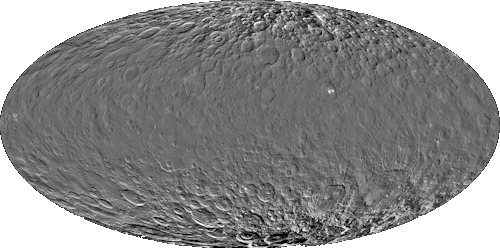
High Altitude Mapping Orbit (HAMO)
Controlled HAMO mosaics
- map resolution: 0.14 km/pixel
- mean Ceres radius: 470 km
- IAU Longitude system
Downloads
clear filter
Release date: 21-Jan-2016
- global ( ISIS cube | PDS image| GeoTiff | PNG)
- northern hemisphere ( ISIS cube | PDS image | GeoTiff | PNG)
- southern hemisphere ( ISIS cube | PDS image | GeoTiff | PNG)
- individual quads ( ISIS cube | PDS image | GeoTiff)
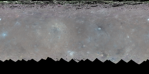
color filters
Release date: 16-Aug-2016
- filter 1
- filter 2
- filter 3
- filter 4
- filter 5
- filter 6
- filter 7
- filter 8
photometrically corrected quads (GeoTiff)
Low Altitude Mapping Orbit (LAMO) & C2E
Uncontrolled LAMO mosaics from Cycles 0, 1, 2, 3, and 4
- map resolution: 0.035 km/pixel
- mean Ceres radius: 470 km
- IAU Longitude system
- Release date: 11-Aug-2016
Downloads
LAMO
- global ( ISIS cube | PDS image| GeoTiff | PNG)
- northern hemisphere ( ISIS cube | PDS image| GeoTiff | PNG)
- southern hemisphere ( ISIS cube | PDS image| GeoTiff | PNG)
- quad 1 ( ISIS cube | PDS image| GeoTiff | PNG)
- quad 2 ( ISIS cube | PDS image| GeoTiff | PNG)
- quad 3 ( ISIS cube | PDS image| GeoTiff | PNG)
- quad 4 ( ISIS cube | PDS image| GeoTiff | PNG)
- quad 5 ( ISIS cube | PDS image| GeoTiff | PNG)
- quad 6 ( ISIS cube | PDS image| GeoTiff | PNG)
- quad 7 ( ISIS cube | PDS image| GeoTiff | PNG)
- quad 8 ( ISIS cube | PDS image| GeoTiff | PNG)
- quad 9 ( ISIS cube | PDS image| GeoTiff | PNG)
- quad 10 ( ISIS cube | PDS image| GeoTiff | PNG)
- quad 11 ( ISIS cube | PDS image| GeoTiff | PNG)
- quad 12 ( ISIS cube | PDS image| GeoTiff | PNG)
- quad 13 ( ISIS cube | PDS image| GeoTiff | PNG)
- quad 14 ( ISIS cube | PDS image| GeoTiff | PNG)
- quad 15 ( ISIS cube | PDS image| GeoTiff | PNG)
C2E
Uncontrolled mosaics from C2E sequences, tiled every 10 degrees + Occator and Urvara
- map resolution: 5 m/pixel
- mean Ceres radius: 470 km
- Longitude system as used for all LAMO products
- Release date: 28-Jan-2019

tiles
- 60°N - 50°N ( 32 bit | 8 bit)
- 50°N - 40°N ( 32 bit | 8 bit)
- 40°N - 30°N ( 32 bit | 8 bit)
- 30°N - 20°N ( 32 bit | 8 bit)
- 20°N - 10°N ( 32 bit | 8 bit)
- 10°N - 0°N ( 32 bit | 8 bit)
- 0°N - 10°S ( 32 bit | 8 bit)
- 10°S - 20°S ( 32 bit | 8 bit)
- 20°S - 30°S ( 32 bit | 8 bit)
- 30°S - 40°S ( 32 bit | 8 bit)
- 40°S - 50°S ( 32 bit | 8 bit)
- 50°S - 60°S ( 32 bit | 8 bit)
regional mosaics
Controlled Occator mosaic
- Controlled Occator mosaic from C2E image sequences, ortho-rectified on LAMO DTM
- map resolution: 5 m/pixel
- mean Ceres radius: 470 km
- Longitude system as used for all LAMO products
- Release date: 12-Oct-2018


